
Old Hutchcomb's Copse
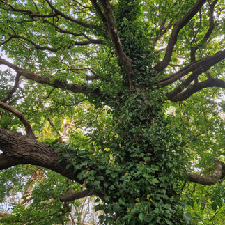
Old Hutchcomb’s Copse is an ancient and semi-ancient native wood (ASNW) on Cumnor Hill close to Oxford City. The 'dreaming spires' may be glimpsed through the trees. The site has been wooded continuously since before 1600. Some of our great oaks are thought to be over 300 years old. The woodland is mixed broadleaves (principally oak and ash), with occasional field maple, hawthorn and an understory of over-mature (large) hazel coppice stools. There are some unusual trees, such as a pink and white horse chestnut, which are non-native species, and have been planted on the top of the woodland. In the woodland areas there are bluebells and other ASNW indicator species. The woodland areas vary in tree density, and results in a tree canopy that gives areas of small glades underneath the trees as well as more secluded areas nearer the houses and on the south western edge of the wood. The woodland runs downhill to a flatter open area (the Glade) and a small stream.
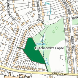
The Copse is the original ancient woodland that gave it's name to the wider area. It falls steeply from Hurst Rise road toward The Louie Memorial Fields. It covers 2.04 acres (0.83 hectares).
Entrance between 87/89 Hurst Rise Rd, Oxford OX2 9HF.
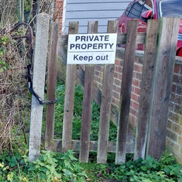
The Copse is privately owned. Access is strictly by invitation only.
Significance
Ancient woods are historically and ecologically important. Thanks to their continuous tree cover and and relative lack of human development they hold unique and complex communities of plants, fungi, insects and other microorganisms. Currently they cover less than 2.5% of the UK. Despite having a high level of protection under planning legislation, ancient woods are still being lost to development. Oxfordshire is one of the least wooded counties in southern England, with much of its ancient woodland cleared for agriculture. Woods and urban tree planting are now recognised at national and local government level as vital to limit climate change and a core element of biodiversity, amenity and landscape building.
The copse is locally significant as an unspoiled green space and wildlife corridor on Cumnor Hill. It is part of an important ecological mosaic of nearby open spaces. It is truly 'a hidden gem' that benefits everyone by acting as a haven for wildlife and native plant species.
History of the Copse
Hutchcomb’s Farm was first recorded as ‘Hundescumb’ in 1284. It’s unusual name – meaning ‘valley of the Hound’ is probably Saxon in origin. The Copse is shown on maps going back to 1600 or earlier and is listed on Natural Englands' Ancient woodland inventory. "Copse" means a small stand of coppiced trees, and the wooded area seems largely unchanged over the years. We are trying to research the history of the Copse Please share your memories and any photos with us.
Areas within the Copse
We have identified 3 main zones within the copse.
Upper wood
The upper wood runs more or less parallel with Hurst Rise Road. It is relatively flat behind the houses but falls away to the north east. This an area of older trees (mainly oak, ash and field maple interspersed with coppiced hazel).
Middle wood
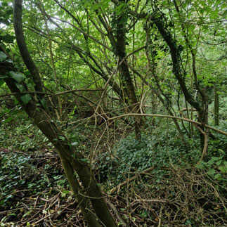
The middle wood is marked by the steepness of the bank which makes it impassible in places. It is an area where we most need to make safe, assessable paths.
Glade & lower wood
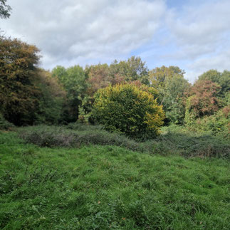
The glade is a an open area where The bank levels out near the stream. The glade has not been grazed for many years and is at risk of being taken over by bramble, nettles, bracken and thistle. We scythe the glade regularly to improve and control this.